Drones in mining help teams survey terrain, measure stockpiles, map underground openings, inspect infrastructure, and document changing site conditions. Equipped with suitable cameras or sensors, they collect information from locations that can be difficult, time-consuming, or hazardous to access.
The right mining drone depends on the job. Mapping an open pit requires a different approach from inspecting an underground stope. The operating environment, required measurements, access conditions, and final deliverables should guide the choice of aircraft and payload.
This guide explains ten practical applications of drones for mining, what each application produces, and how to choose a system that fits your operation.
How Are Drones Used in Mining?
Mining drones carry sensors to collect imagery, spatial measurements, or other site information. That data is then reviewed or processed into outputs such as maps, point clouds, volume calculations, inspection records, and change comparisons.
| Application | Typical environment | Useful outputs | Decision supported |
|---|---|---|---|
| Mine surveying and mapping | Surface mines and quarries | Orthomosaics, terrain models, contours | Site planning and progress tracking |
| Stockpile measurement | Stockyards and material storage areas | Surface models and volume reports | Inventory and material management |
| Stope and cavity mapping | Underground mine openings | Point clouds, meshes, sections | Reconciliation and excavation review |
| Ore-pass and inaccessible-opening inspection | Suitable underground workings | Visual records and spatial data | Investigation and maintenance planning |
| Drill-and-blast assessment | Surface and suitable underground areas | Before-and-after models and imagery | Blast review and subsequent planning |
| Highwall and slope observation | Open pits and quarries | Detailed imagery and repeat surveys | Geotechnical review |
| Infrastructure and thermal inspection | Mine buildings and processing facilities | Inspection images and thermal records | Maintenance prioritization |
| Exploration and geological surveys | Prospective mineral areas | Terrain, imagery, and specialist sensor datasets | Exploration targeting |
| Environmental and rehabilitation monitoring | Tailings areas, disturbed land, and closure sites | Repeat maps and environmental observations | Monitoring and rehabilitation planning |
| Emergency assessment and site surveillance | Accessible, approved operating areas | Live views and incident records | Response coordination and site security |
These applications require different equipment and procedures. A drone configured for one task should not automatically be assumed suitable for another.
1. Surveying and Mapping Surface Mines
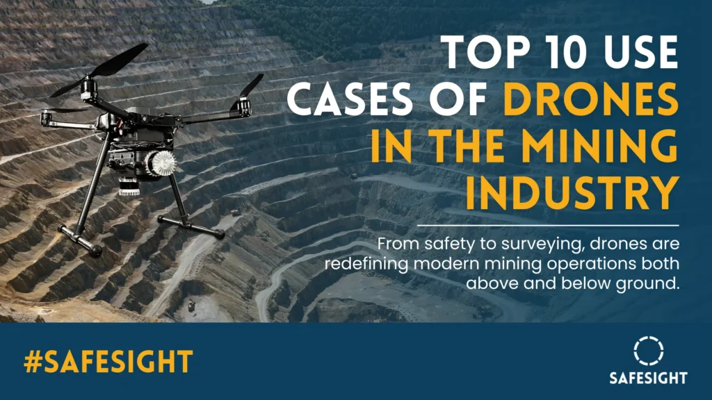
Mine plans depend on an accurate understanding of current conditions. Excavation, material movement, road construction, and changes to working areas can quickly make older maps less useful.
Drones can capture overlapping photographs or LiDAR measurements across an accessible survey area. After processing and quality checks, the resulting maps help teams review terrain, track progress, and communicate site changes.
What the survey should deliver
Define the required output before planning the flight. A visual progress map, a terrain model for engineering work, and a survey tied to the mine’s coordinate system have different requirements.
Useful deliverables can include orthomosaics, elevation models, contours, and georeferenced point clouds. Survey control, independent checks, and clear documentation help establish whether the output is suitable for its intended use.
Explore SafeSight’s mine surveying solutions for the broader capture-to-deliverable workflow.
2. Measuring Stockpile Volumes
Stockpile measurement is a practical application of drones in mining because it connects spatial data with day-to-day material management.
A drone survey captures the pile’s surface. Processing software then calculates volume relative to a defined base. Repeated surveys can help teams monitor inventory changes and investigate differences between measured quantities and operational records.
Volume and tonnage are different measurements
A surface model provides a basis for estimating volume. Converting that volume to tonnage also requires an appropriate bulk-density value. An accurate surface survey cannot compensate for an unsuitable density assumption.
The base surface, pile boundaries, obscured areas, and survey method also affect the result. For repeat measurements, use a consistent procedure and document changes that could influence comparisons.
Flight time is only one part of the workflow. Allow for processing, checking, and reporting before treating a measurement as ready for operational use.
3. Mapping Underground Stopes and Cavities
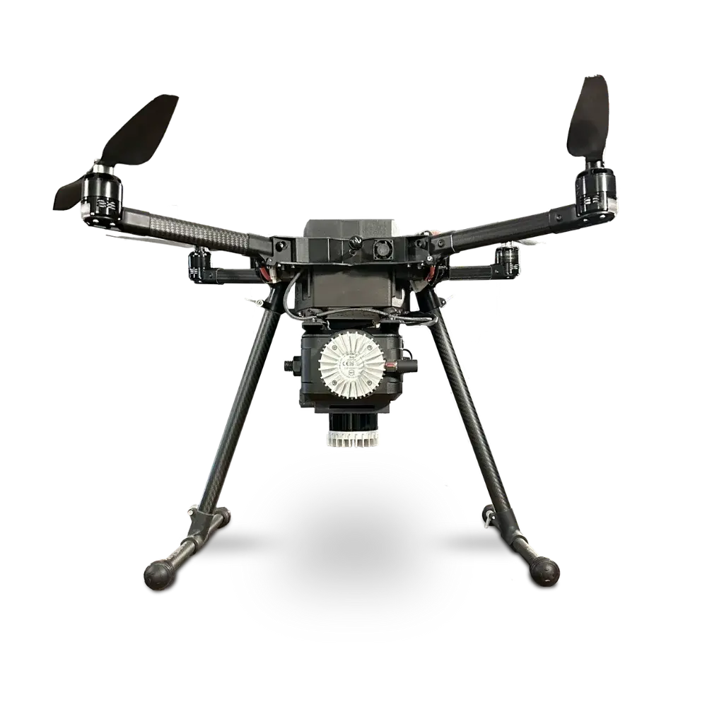
Underground openings present a different challenge from surface surveys. GPS is generally unavailable, access may be restricted, and a survey taken from one position may leave parts of the opening unobserved.
A suitable underground mining drone can move the sensor into an opening to capture additional perspectives. Where conditions permit, this can improve the spatial record available for reviewing the excavation.
Turning captured geometry into useful comparisons
Stope data can support volume assessment, comparison with the planned excavation, and investigation of overbreak or underbreak. The usefulness of those comparisons depends on coverage, registration, and the quality of the reference design.
A visually impressive point cloud is not enough by itself. The survey team needs to understand gaps, uncertainty, and whether the data meets the project’s requirements.
Learn more about stope inspection and surveying and SafeSight’s DBV underground mining drone.
4. Inspecting Ore Passes and Inaccessible Openings
A blockage, damaged surface, or unfamiliar void can leave a mine team with an immediate question: what is happening beyond the area they can safely observe?
Where the opening and operating conditions are suitable, a drone can collect visual or spatial information to support that investigation.
Plan for access, communication, and recovery
The inspection plan should address entry dimensions, available clearance, dust, visibility, airflow, communication limits, and recovery options. These conditions may restrict how far the aircraft can travel or what it can capture.
Visual imagery and spatial measurements answer different questions. Video may help locate an obstruction, while a point cloud may help describe its position and surrounding geometry.
The inspection provides evidence for the responsible team to assess. It does not, by itself, establish that an opening is safe for personnel entry.
5. Supporting Drill-and-Blast Assessment
Drone data can help document conditions before and after blasting.
Before a blast, a suitable survey can provide a record of accessible terrain or excavation geometry. After the area has been released for the planned activity, a follow-up survey can help teams review changes and investigate the outcome.
Make the comparison repeatable
Before-and-after datasets should use compatible coordinates, suitable coverage, and documented survey methods. Otherwise, differences between models may reflect capture or processing inconsistencies rather than actual changes.
Depending on the operation and sensor setup, imagery and models can support reviews of excavation shape, material distribution, or visible fragmentation. Those observations should be interpreted alongside the mine’s blast records and engineering analysis.
6. Documenting Highwalls and Slopes
Highwalls and steep slopes can be difficult to observe closely from accessible ground positions. Drone imagery can provide additional perspectives for qualified personnel reviewing exposed surfaces.
Repeated capture can also build a visual and spatial record of how an area changes over time.
Use observations within the geotechnical programme
Image resolution, viewing angle, lighting, vegetation, and coverage influence what can be observed. Repeat models require suitable alignment and quality checks before apparent changes are treated as measured movement.
Drone surveys can supplement geotechnical assessment. They should not be presented as a substitute for the instruments, inspections, or engineering decisions required by the mine’s monitoring programme.
7. Inspecting Infrastructure and Thermal Conditions
Mining operations depend on buildings, conveyors, processing equipment, and other infrastructure that require regular attention.
Suitable drones can help collect visual records of accessible assets. With an appropriate thermal payload, they may also document temperature patterns for maintenance teams to investigate.
Match the sensor to the inspection question
A visual inspection may require sufficient detail to examine an exposed connection or surface. A thermal inspection needs a suitable sensor, appropriate operating conditions, and knowledgeable interpretation.
A temperature difference is an observation, not a complete diagnosis. Likewise, a camera cannot establish every internal condition or replace hands-on testing where that is required.
Some assets also suit a different capture platform. For example, mine shaft inspection and scanning may call for a deployment method designed specifically around the shaft and its infrastructure.
8. Supporting Mineral Exploration and Geological Surveys
Drones can help exploration teams collect information across prospective areas, particularly where access on foot is difficult or extensive ground coverage would take considerable effort.
Applications can include terrain mapping, imaging exposed geology, and carrying specialist sensors for a defined survey objective.
Separate mapping from mineral detection
A camera or LiDAR system does not directly establish the presence, grade, or economic value of a buried orebody. Different sensors measure different properties, and their outputs require geological interpretation.
The appropriate payload depends on the question being investigated. Terrain models, imagery, and specialist geophysical datasets can complement field observations, sampling, and subsequent exploration work.
For a closer look at this application, read our guide to drones for mining exploration.
9. Monitoring Environmental Conditions and Rehabilitation
Mining sites change throughout development, operation, and closure. Repeat drone surveys can help document disturbed areas, drainage features, vegetation cover, and rehabilitation progress.
A consistent photographic or mapped record can make changes easier to review and communicate.
Collect information that matches the monitoring objective
Environmental monitoring may require more than standard imagery. Water quality, gases, dust, and other parameters require appropriate measurement equipment and methods.
For tailings facilities, drone observations should form part of the wider inspection and monitoring programme. Surface imagery alone cannot establish internal dam condition or demonstrate structural stability.
Repeat capture is most useful when survey timing, coverage, and processing methods are documented consistently.
10. Providing Emergency Assessment and Site Surveillance
Drones can give response personnel an additional view of an incident area, access route, or site perimeter when flight conditions permit.
Visual or thermal information may help teams understand the extent of an incident and coordinate their next steps. Routine aerial observations can also support investigation of perimeter activity.
Suitability comes before deployment
Smoke, heat, dust, restricted access, unstable structures, and communication loss can limit a mission. A drone suitable for normal inspection work is not automatically suitable for an emergency environment.
Do not assume an ordinary drone is approved for an explosive atmosphere. Equipment selection and deployment must follow the site’s requirements and incident procedures.
Explore SafeSight’s emergency response and mine rescue solutions for related remote-assessment applications.
Surface vs. Underground Mining Drones
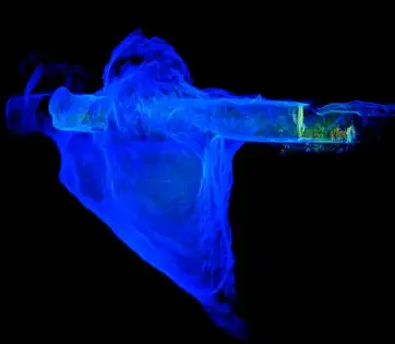
“Mining drone” describes an application category rather than one universal aircraft. Start with the environment in which the system will operate.
| Selection factor | Surface operations | Underground operations |
|---|---|---|
| Positioning | Satellite positioning may be available | GPS is generally unavailable |
| Operating space | Often larger areas with outdoor obstacles | Confined openings and complex geometry |
| Visibility | Influenced by daylight, weather, and dust | Influenced by darkness, dust, and onboard lighting |
| Access | Launch areas and airspace constraints | Entry dimensions, clearances, and operator position |
| Communications | Terrain and distance affect links | Rock, bends, and geometry can restrict links |
| Common outputs | Site maps, terrain models, stockpile reports | Point clouds, cavity geometry, visual inspection records |
| Key selection question | Can it cover the area at the required quality? | Can it safely access and adequately capture the opening? |
A specification sheet should be assessed against the actual task. Flight time, sensor output, navigation capability, and communication range only become useful when considered together with site conditions.
How to Choose Drones for Mining
Start with the decision and deliverable
Write down the question the mine needs answered. Is the priority stockpile volume, excavation geometry, an inaccessible obstruction, or a maintenance observation?
Then define what the receiving team needs: a visual record, a registered point cloud, a mesh, a volume report, or another agreed output.
Check the complete workflow
Evaluate setup, capture, processing, quality assurance, and delivery. A short flight offers limited value if the resulting information requires extensive rework before anyone can use it.
Confirm who operates the system, who checks the data, and how the result enters the mine’s existing workflow.
Ask for evidence relevant to your site
A useful demonstration should resemble the conditions and deliverables of the intended project.
Ask to review coverage, identified gaps, sample outputs, and the method used to assess quality. For a time-saving claim, ask whether the comparison includes preparation, processing, and reporting—not just flight duration.
Assess support and repeatability
Training, maintenance, replacement parts, data ownership, and ongoing support affect the practicality of a drone programme.
A repeatable process is especially valuable where the mine plans to compare conditions over multiple surveys.
Measuring the Value of a Mining Drone Workflow
The most useful business case starts with the current task.
Record the crew involved, setup time, capture time, processing time, reporting requirements, and any operational interruption. Compare the proposed drone workflow against the same scope and deliverable.
| Measure | What to record |
|---|---|
| Elapsed time | Time from preparation to an accepted deliverable |
| Labour hours | Combined time contributed by everyone involved |
| Coverage | Required areas captured and any remaining gaps |
| Rework | Repeat visits, reflights, or additional processing |
| Operational impact | Any access restrictions or interruptions |
| Data usability | Whether the result meets the receiving team’s requirements |
Keep elapsed time and labour hours separate. A task taking one hour with three people represents three labour hours.
For a wider discussion, explore the benefits of drones in mining.
Using SafeSight for Underground Drone Mapping
For teams evaluating underground capture, SafeSight’s DBV platform is a starting point for discussing drone-based mapping of suitable mine openings.
The right conversation begins with your site: what needs to be captured, how it can be accessed, and what the survey or engineering team needs to receive.
Explore the DBV underground mining drone to review the product, or contact SafeSight to discuss your application.
Frequently Asked Questions
What are drones used for in mining?
Drones are used for surveying, stockpile measurement, underground mapping, visual inspections, geological data collection, environmental observations, and emergency assessment. The application depends on the aircraft, payload, operating conditions, and site procedures.
Can drones operate underground without GPS?
Some purpose-built systems support operation without GPS using other positioning or navigation methods. Their suitability must be assessed for the opening, visibility, communications, and required mission. A standard surface mapping drone should not automatically be considered suitable underground.
What is the best drone for mining?
There is no single best drone for every mining task. Select the system against the operating environment, required deliverable, access conditions, data-quality requirements, and support needs.
Do mining drones use LiDAR or cameras?
They may use either or both, depending on the task. Cameras capture visual information and can support photogrammetric modelling. LiDAR measures distances to build spatial datasets. A visual inspection, terrain survey, and underground cavity survey may require different configurations.
Can a drone replace a mine surveyor?
A drone is a capture tool within a survey workflow. Planning, control, verification, interpretation, and acceptance of the results still require appropriate expertise.
Are drone measurements available in real time?
Some systems provide live imagery or a developing spatial view. Final measurements and engineering deliverables may still require processing, registration, and quality checks. Confirm the difference between a live preview and an accepted final output.
How much time can drones save in mining?
Savings depend on the site, task, existing method, crew, and required deliverable. Assess the complete workflow through a representative trial rather than applying a general percentage to every operation.
Discuss Your Mining Application
Whether you need to document a mine opening, improve access to inspection information, or establish a repeatable capture process, begin with the result your team needs.
Tell SafeSight what you need to inspect or map, the access constraints, and the expected deliverables.
Discuss your mining inspection or mapping requirements with SafeSight.