How Mining Drones Improve Safety & Efficiency for Mining Operations
Recent advancements in mining drone technology have provided mining companies with invaluable tools to improve resource management, operation planning and mining personnel safety across a wide variety of mining sites.
These improvements have been driven by advanced lidar drone technology that can be used to support mining operations by delivering a highly accurate site model thanks to lidar drone data. Lidar mining drones provide critical support for mining industry site operations in the three key areas:
- Inventory & resource management
- Monitoring and inspection
- Personnel safety
Mining Industry Applications for Lidar Drone Technology

Remotely operated equipment permits far greater data collection and hazard identification capabilities than traditional, manual methods.
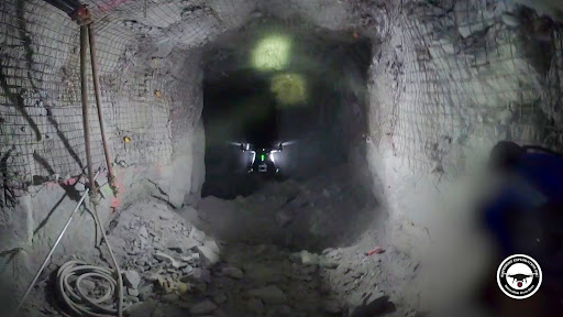
Particularly helpful for surveying confined areas, lidar mining drones can capture both visual data, such as high resolution images and video, as well as geospatial information, in the form of highly accurate 3D point clouds for detailed mapping. These capabilities keep mine personnel out of harm’s way and allow for better informed decisions between planners, engineers and teams underground.
The data collected from mining drones can facilitate mining operation improvements in the following areas:
Inventory & Financial data
Rapidly generated aerial terrain models help mining industry stakeholders collect and analyze up-to-date information about all aspects of mining sites, including stockpiles, for easy and accurate volume calculations.
This data improves the accuracy of monthly or annual reconciliations, and it can also be used to help mining companies audit work performed by subcontractors.
Stockpile & Tailing Dam Management
Both tailings dams and stockpiles present significant hazards for mining personnel. Especially with stockpiles, accurately assessing a large volume of loose material is difficult and hazardous with manual methods, which is why it is one of the leading lidar drone applications.
The benefits for stockpile management are immediate, allowing mining companies to accurately assess the remaining ore in a particular site to improve financial projections and reporting, while maximizing employee safety.
Underground Monitoring & Inspection
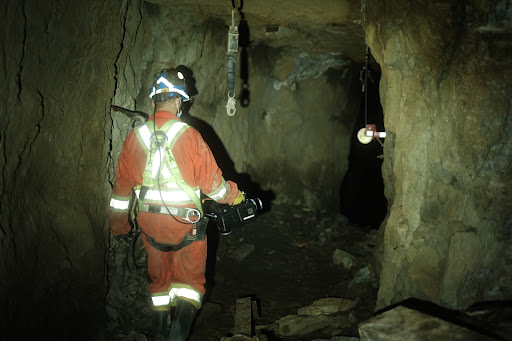
Workers on deep underground mine sites face significant hazards and risks, including falling rocks and debris, floods, gas leaks, extreme humidity and others. By using mining drones to collect data in these environments, mining companies can protect their workers from these hazardous conditions while gaining significant improvements to operational efficiency.
Lidar & Photogrammetry for Mining Surveys
Mining drones can generate aerial terrain models and digital surface models of complex environments in a small fraction of the time and cost of traditional surveying methods.
For outdoor sites, aerial data with geospatial information permits aerial photogrammetry, which creates detailed digital surface models to assess changes over time and improve future planning. Also, in underground environments, lidar mapping can be used to create digital terrain models for low-cost surveying in short times frames.
Safety Improvements
The implementation of mining drones has improved worker safety across the mining industry by removing workers from dangerous environments.
Difficult tasks, such as highwall, crest and stope inspections, can now be assessed for safety considerations without ever having to expose a miner to the area. Similarly, blast engineering is facilitated because workers can make sure that, following a detonation, the area is safe for workers to continue mining operations.
SafeSight’s Drone Technology

SafeSight Explorations Inc. supports the digital transformation of mining operations through innovative mining equipment and integrated solutions.
The DB3 Underground Lidar Drone and SafeScout ERD combines cutting-edge lidar technology with an open platform flight controller for underground lidar surveys and photogrammetry. Ideal for surveying, data collection and incident investigation, the DB3 is a versatile solution to a wide variety of mining industry challenges.

