Emergency Response Drone

SafeScout™ - ASR (Air Search & Rescue)

Transforming Emergency Response Safety
(705) 707 2487
SafeScout - Emergency Response Drone as Firefighting Drone

Emergency Response - Rescue or Recovery

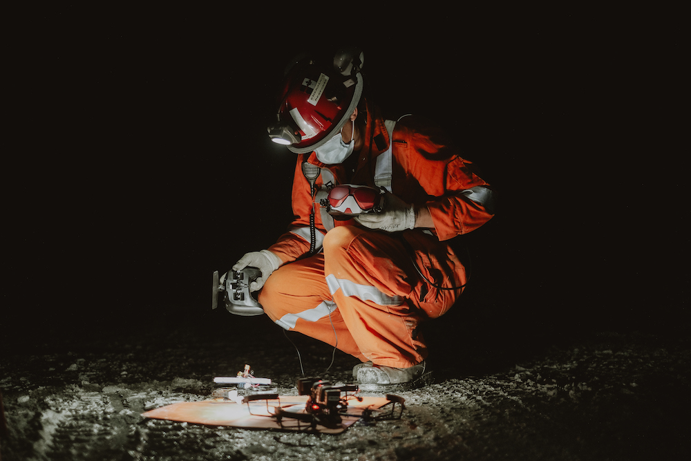
The ERD is small, light and can be deployed quickly to execute search and rescue. Being able to fit through areas as tight as 40 cm x 40 cm and a range of 200m+ makes it possible to rapidly determine “Rescue or Recovery” without ever putting rescue personnel at risk.

Real Time Visual Assessment

Equipped with both a Thermal and HD FPV Camera, the ERD can fly into targeted ares and give responders HD and Thermal video of the site environment.

ERD - SafeScout™

Changing Underground Development
SafeScout - Emergency Response Drone as Firefighting Drone

Altitude Hold for Underground Mobility

To support pilot control as well as ease of operation, the ERD is equipped with Altitude Hold. This feature allow for pilots to be able to focus on direction while the drone maintains a consitant altitude to help pilots navigate through tight spaces.

Fire & Smoke Response

With ERD Models equipped with thermal imaging, the ERD is able to fly around a fire to provide a thermal image assessment of the backside of the fire. These features allow responders to assess an emergency with detailed information, while at a safe distance.
Use Unmanned Aircraft Systems for a Safer & Faster Response

Emergency Response, Support and Rescue

Physical Specifications

Weight

0.58 kg / 0.62 kg

Dimentions

22 cm x 22 cm x 15 cm

Run Time

7 min - 8 min

Accessories

Goggles, Controller, Batteries, Charger, Storage case, Operator Vest

ERD - SafeScout™

Transforming Emergency Rescue Operations
SafeScout - Emergency Response Drone as Firefighting Drone

The ERD is small, light and can be deployed quickly to execute search and rescue. Being able to fit through areas as tight as 40 cm x 40 cm and a range of 200m+ makes it possible to rapidly determine “Rescue or Recovery” without ever putting rescue personnel at risk.

Equipped with both a Thermal and HD FPV Camera, the ERD can fly into targeted ares and give responders HD and Thermal video of the site environment.

To support pilot control as well as ease of operation, the ERD is equipped with Altitude Hold. This feature allow for pilots to be able to focus on direction while the drone maintains a consitant altitude to help pilots navigate through tight spaces.

With ERD Models equipped with thermal imaging, the ERD is able to fly around a fire to provide a thermal image assessment of the backside of the fire. These features allow responders to assess an emergency with detailed information, while at a safe distance.

ERD - ASR1

ERD - ASR2

ERD - ASR3

ERD Pilot

Download Product Specifications

Unlock the future of underground emergency response—download the SafeScout ERD specs and experience the power of precision and innovation in every flight

FAQ

Know More About Emergency Response Drones

Emergency response drones are specialized UAVs (unmanned aerial vehicles) designed for rapid deployment in crisis situations. They assist in disaster management by providing aerial views, mapping affected areas, delivering medical supplies, and aiding search-and-rescue operations.

Emergency Response Drones can be quickly deployed to disaster zones, bypassing roadblocks and other obstacles. They gather real-time data, assess the extent of damage, and help responders prioritize their efforts, significantly reducing response times.

Yes, drones are increasingly being used to deliver medical supplies such as vaccines, blood, and medications to remote or inaccessible areas during emergencies, ensuring timely assistance.

Drones provide aerial surveillance over large areas, identifying survivors using thermal imaging and pinpointing their exact locations for rescuers to act swiftly.

AI enables drones to autonomously analyze data, identify patterns, and make decisions in real-time, such as detecting survivors or prioritizing critical areas for rescue.

While the initial investment in drones and their technology can be high, they significantly reduce operational costs by speeding up rescue operations, minimizing human risk, and enhancing efficiency. Read more about Cost-Benefit Analysis: Investing in Disaster Drones

Common challenges include navigating poor weather conditions, battery limitations, and ensuring communication in areas with limited connectivity. Advances in technology are addressing these issues.
Read more about Overcoming Challenges in Drone-Based Disaster Management

Yes, drones equipped with LiDAR and photogrammetry technology can create accurate 3D maps of disaster zones, aiding in planning and coordination of relief efforts.

Emerging technologies such as AI-driven automation, swarm drones, and longer-lasting batteries promise to make disaster response drones even more efficient and versatile in the future.
Read more about : The Future of Disaster Drones: Emerging Technologies and Trends

Absolutely, drones can track recovery progress by providing updated maps, assessing structural repairs, and monitoring environmental changes in affected areas.

Disaster response drones are designed to be robust, weather-resistant, and capable of navigating challenging environments such as debris, smoke, or waterlogged areas.
Read More on Complete Buying Guide Features of Disaster Response Drones

Industries such as emergency services, mining, agriculture, and construction benefit from drones by improving safety and efficiency during disaster and emergency situations.