
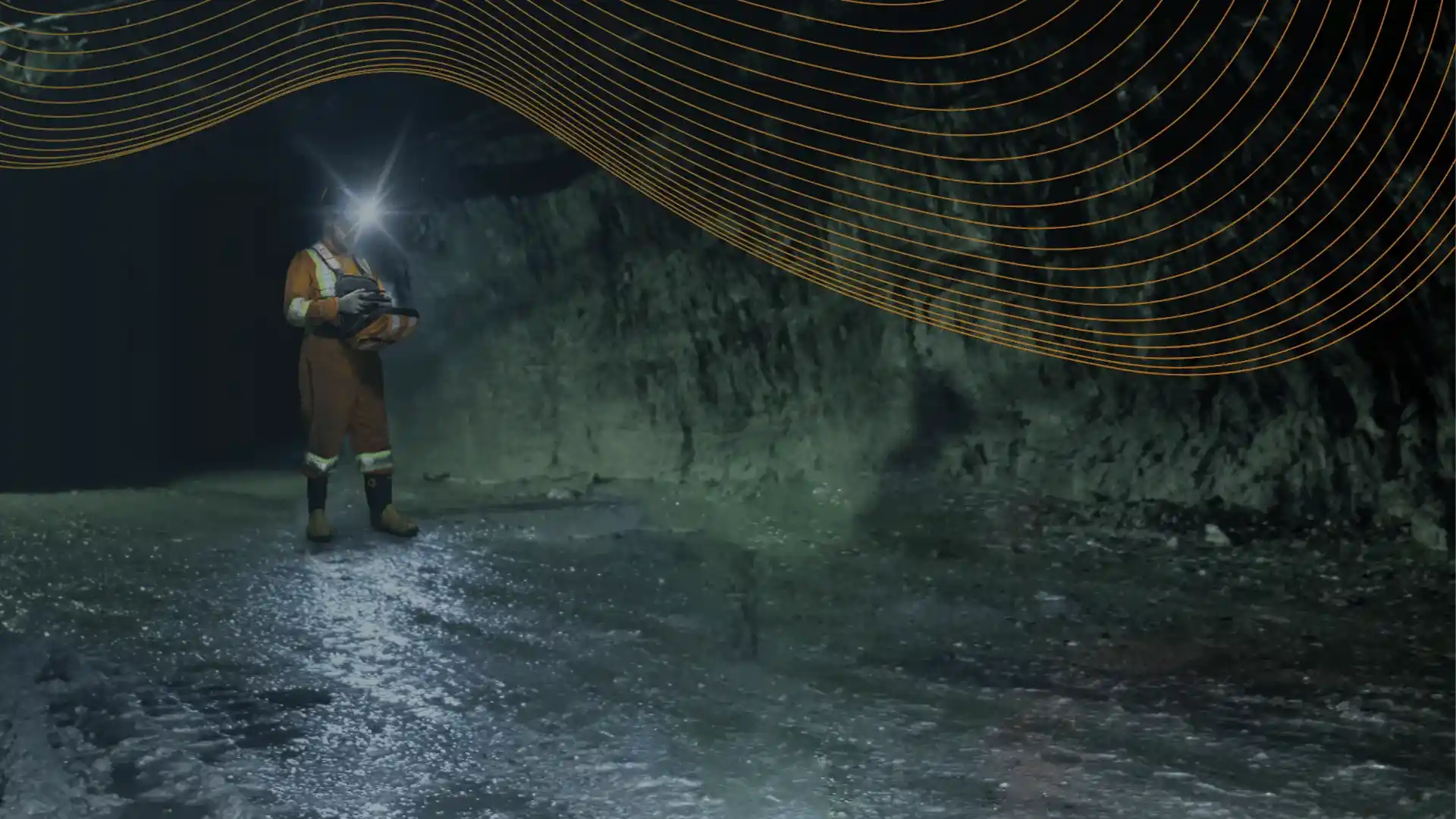
STOPE SURVEYING 01
Stope Inspection & Surveying
Know What Was Actually Mined.
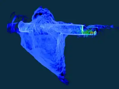
SafeSight captures high-density 3D geometry inside underground stopes so survey, planning and engineering teams can compare the actual excavation against design. Measure volume, identify overbreak and underbreak, support reconciliation and document post-blast geometry using a capture method selected for the opening.
Volume. Overbreak. Reconciliation.
3D GEOMETRY
Complete measurable cavity representation
VOLUME
Actual excavation volume
DESIGN COMPARISON
Planned vs as-built geometry
RECONCILIATION
Geometry for overbreak / underbreak review
A Brow View Does Not Always Tell You What Happened Inside the Stope.
Stope geometry is rarely simple.
Irregular excavation, corners, hanging-wall geometry and line-of-sight limitations can make it difficult to understand an entire cavity from one accessible position.
Incomplete geometry can affect:
- Volume calculations
- Design-to-as-built comparison
- Dilution analysis
- Overbreak review
- Underbreak review
- Reconciliation
- Backfill planning
- Subsequent blast decisions
YOU CANNOT RECONCILE WHAT YOU DID NOT CAPTURE.
01 Workflow
From Post-Blast Opening to Measurable Stope Geometry.
CAPTURE
Deploy the capture system suited to the opening. For suitable inaccessible cavities this may include the DBV underground drone carrying SafeSight LiDAR into GPS-denied stope geometry.
PROCESS
Clean, geo-reference and prepare the captured point cloud using SafeSight's mining spatial-data workflow.
DELIVER
Provide measurable geometry, volume information and compatible outputs for mine survey, planning and reconciliation.
02 Measurements
More Than a 3D Picture of the Void.
ACTUAL VOLUME
Measure the excavated cavity rather than estimating solely from planned geometry.
OVERBREAK
Identify excavation extending outside the intended design envelope.
UNDERBREAK
Identify areas where planned material remains within the design.
DESIGN-TO-AS-BUILT
Overlay surveyed geometry against the planned stope.
CAVITY SHAPE
Understand irregular walls, backs and surfaces that influence technical decisions.
REPEAT RECORDS
Retain stope geometry as part of the mine's historical spatial record.
03 Operations
Turn the Stope Survey Into a Reconciliation Input.
A stope survey becomes commercially useful when the geometry can be compared with what the mine intended to extract.
Processed stope geometry can support technical review of:
- Actual excavation volume
- Design compliance
- Overbreak
- Underbreak
- Dilution
- Remaining ore
- Blast performance
- Backfill requirements
SafeSight does not replace the mine's reconciliation process.
We provide spatial data that can strengthen it.
04 Platform
Need the Data, Not the Drone?
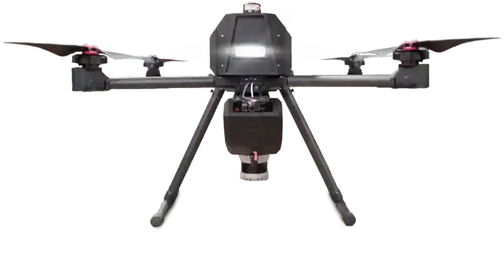
DBV is SafeSight's underground aerial mapping product.
Stope Inspection is the service outcome.
For a mine that simply needs a stope surveyed, SafeSight selects the appropriate capture method, completes the field workflow and delivers the resulting geometry.
05 Verification
Check the Capture Before Leaving the Stope Area.
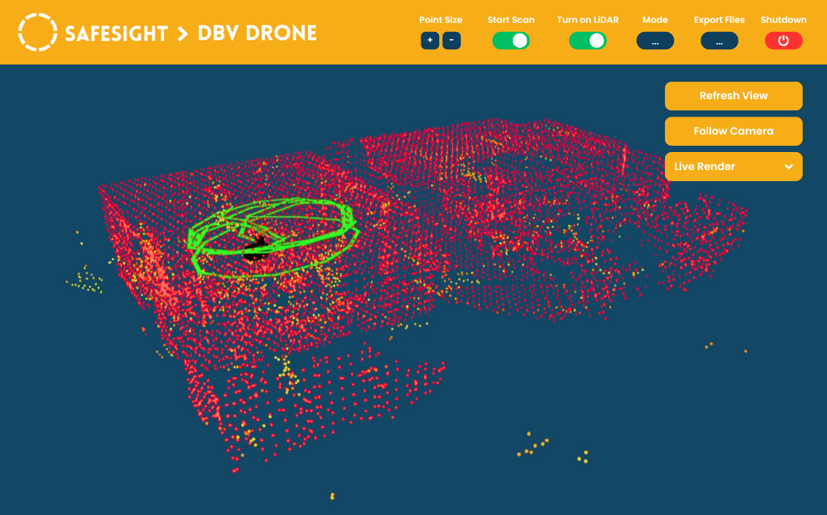
Where compatible with the selected platform, SafeSight Live Render allows the operator to see the developing point cloud during the field workflow.
This can help identify potential coverage gaps before equipment and the survey crew leave the area.
06 Deliverables
Stope Survey Deliverables Built for Mine Planning.
* Final deliverables should be scoped per project.
07 Data Pipeline
From Stope Scan to Mine-Ready Data.
DBV / APPROPRIATE PLATFORM
Deploy the capture system suited to the opening.
CONTROL APP
Monitor scan progress where applicable.
ECLIPSED
Clean, geo-reference and prepare point-cloud data.
NIMBVAULT
Organize, visualize, measure and retain spatial data.
MINE PLANNING
Move data into DESWIK / VULCAN / SURPAC / MINEPLAN
08 In Practice
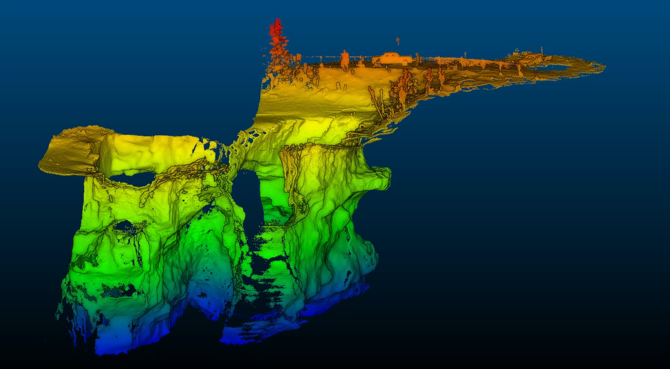
A Published SafeSight Stope Mapping Example
SafeSight has previously published a field example describing a typical stope capture workflow of approximately 15 minutes using mobile drone LiDAR compared with approximately 45 minutes for the traditional CMS workflow referenced in that example.
The same article discussed improved visibility of the stope geometry in the referenced deployment.
PUBLISHED SAFESIGHT FIELD EXAMPLE
09 Resources
Related Reading
Drones for Stope Mining Survey
Read Article →Real-Time 3D Mapping in Mines Using Drones
Read Article →Underground Mapping for Stopes, Drifts & Raises
Read Article →10 Fundamentals
Explore Stope Surveying
What Is Stope Surveying?
Stope surveying measures the actual geometry of an underground excavation so the mine can understand the volume and position of material removed.
Modern stope surveys may use LiDAR or other spatial capture methods to create a three-dimensional representation of the cavity.
The resulting geometry can support production reporting, reconciliation, design comparison and future mine planning.
Why Is Stope Geometry Important?
A planned stope represents the intended excavation.
The actual stope can differ because of blast performance, rock conditions and excavation behaviour.
Surveying the resulting cavity allows technical teams to compare planned geometry against what was actually mined.
Stope Surveying vs Stope Inspection
The terms overlap but emphasize different outcomes.
Stope surveying focuses on measurable cavity geometry.
Stope inspection can also include visual or condition assessment of the opening.
SafeSight's service combines spatial capture with inspection workflows where the selected platform supports them.
11 Questions
Frequently Asked Questions
01What is stope surveying?
Stope surveying measures the actual geometry of an underground excavation so the mine can understand the volume and position of material removed. Modern surveys utilize LiDAR or other spatial capture methods to create a measurable 3D representation of the cavity.
02Can SafeSight measure stope volume?
Yes. By capturing a high-density 3D point cloud of the opening, SafeSight provides the spatial data required to accurately calculate the actual excavated volume rather than estimating from design plans.
03Can the survey identify overbreak and underbreak?
Yes. The processed 3D geometry can be overlaid against the planned stope design to highlight areas where excavation extended outside the intended envelope (overbreak) or where planned material remains (underbreak).
04Can SafeSight map a stope without entering the cavity?
Yes. SafeSight deploys capture platforms such as the DBV underground drone that can navigate GPS-denied environments, allowing for comprehensive mapping while personnel remain safely outside the unsupported cavity.
05Does SafeSight use drones for every stope?
No. SafeSight evaluates each opening and selects the appropriate capture method based on the specific geometry, access limitations, and required technical outputs.
06How is the data delivered?
Deliverables are scoped per project and can include raw point clouds, georeferenced geometry, meshes, volume calculations, and compatible technical files that integrate directly with mine planning software like Deswik, Vulcan, or MinePlan.
07Can SafeSight compare the stope against design?
Yes. Design-to-as-built comparison is a primary application. The surveyed geometry can be compared against the planned stope to assess design compliance and support reconciliation.
08Does a drone replace conventional mine surveying?
No. SafeSight provides high-density spatial data that strengthens the mine's existing survey and reconciliation workflows. It is a complementary tool designed to return detailed geometry from inaccessible or complex areas.
09Can repeat stope scans be retained for historical comparison?
Yes. Captured geometry becomes a permanent part of the mine's spatial record, which can be managed via NimbVault and referenced for future blast decisions or historical review.
What Do You Need to Know About the Stope?
Tell us the opening, current survey method and technical output you need.
SafeSight will recommend the capture method and scope the survey around the decision your team needs to make.