Mining surveying is essential for accurate resource estimation, operational planning, and safety compliance. Historically, traditional surveying methods have been the industry standard. However, the rise of unmanned aerial vehicles (UAVs), commonly called drones, has introduced powerful alternatives that are reshaping mining site data collection.
If you’re wondering how mining UAVs stack up against conventional techniques, what benefits or challenges they bring, and whether they’re right for your operation, this blog will answer those questions. We’ll break down the core differences, practical considerations, and how UAV technology complements or replaces traditional methods.
What Are Traditional Mining Surveying Methods?
Traditional mining surveys usually involve:
- Ground-Based Surveying: Using total stations, GPS rovers, and laser scanners operated by field crews to map mine sites.
- Manned Aerial Surveys: Aircraft or helicopters equipped with cameras or LiDAR sensors capturing large-scale spatial data.
- Manual Volume Calculations: Using handheld equipment and calculations based on sample measurements.
These methods have been trusted for decades, relying heavily on human expertise and often labor-intensive fieldwork.
What Are Mining UAVs (Drones), and How Do They Work?
Mining UAVs are specialized drones equipped with sensors such as high-resolution cameras, LiDAR, or multispectral imagers designed for mining environments. They fly over or inside mines to capture spatial data quickly and accurately.
Drones can cover large or difficult-to-access areas without risking personnel, generating georeferenced imagery and 3D models for analysis. They often come with flight automation software to conduct repeatable surveys with minimal pilot input.
How Do UAVs Compare to Traditional Methods in Survey Speed?
One of the biggest advantages of mining drones is speed:
- UAV Surveys: Can cover large areas in hours, with rapid data processing turning results around in days.
- Traditional Ground Surveys: Often take days or weeks due to the need for manual measurements and site access challenges.
- Manned Aerial Surveys: Faster than ground surveys but require scheduling, expensive aircraft, and airspace permissions.
UAVs drastically reduce surveying time, enabling more frequent updates and real-time decision-making.
What About Survey Accuracy and Data Quality?
Accuracy is critical in mining surveys:
- Mining UAVs: With advanced sensors like LiDAR and high-res photogrammetry, drones achieve centimeter-level accuracy, often matching or exceeding traditional GPS surveys.
- Traditional Methods: Ground surveying can be highly accurate but is susceptible to human error and limited by terrain or hazards.
- Manned Aircraft: Provide broad coverage but sometimes with lower resolution than drones flying closer to the ground.
Drones excel in producing dense, high-quality 3D point clouds and orthomosaics that support precise measurements and analysis.
How Do Safety Considerations Differ?
Mining is a high-risk environment, so safety is paramount:
- UAVs: Remove humans from hazardous zones such as steep pit edges, unstable ground, or underground tunnels, reducing accident risk.
- Ground Surveys: Require personnel to work in risky conditions, potentially exposing them to landslides, heavy machinery, or poor air quality.
- Manned Flights: Also safer for crews than ground surveys but expose pilots and observers to aviation risks and are limited underground.
UAVs contribute significantly to improving mine site safety.
What Are the Cost Differences Between UAVs and Traditional Surveying?
Cost efficiency is a major factor when choosing surveying methods:
- UAV Surveys: Require upfront investment in drones and software but lower ongoing costs by reducing labor, flight hours, and equipment rental.
- Traditional Ground Surveys: Labor-intensive with costs increasing significantly for large or complex sites.
- Manned Aerial Surveys: Very expensive due to aircraft operation, maintenance, and specialized crew.
Many mines see UAVs as a cost-effective option that delivers fast, accurate results without breaking the budget.
How Flexible Are UAVs Compared to Traditional Methods?
Flexibility is key in dynamic mining operations:
- Drones: Easily deployed on demand, fly in confined spaces, tunnels, and steep pit walls, and repeat surveys quickly with automated flight plans.
- Ground Surveys: Limited by access, weather, and terrain obstacles, making rapid or repeated surveys difficult.
- Manned Flights: Require advance planning, good weather, and are restricted in underground or narrow areas.
Drones adapt better to evolving mine site conditions and urgent data needs.
Can UAV Data Be Integrated Into Existing Mining Systems?
For survey data to be useful, it must integrate with mine planning and management software:
- UAV Data: Compatible with CAD, GIS, and mine modeling software, producing versatile outputs like point clouds, orthomosaics, and volumetric reports.
- Traditional Data: Often collected in formats that also integrate well but may require more manual processing or merging.
- Manned Aircraft Data: Similar integration potential but sometimes less detailed.
Modern UAV platforms often include cloud-based tools for real-time collaboration and data sharing.
Are There Limitations or Challenges With UAV Surveys?
Despite advantages, UAVs have some challenges:
- Regulatory Compliance: Drone flights require permits, especially in controlled airspace or near populated areas.
- Battery Life & Weather: Limited flight time and poor weather can impact data collection schedules.
- Data Processing: Requires expertise and software to convert raw data into actionable insights.
- Initial Training & Investment: Teams need training to operate drones and interpret data effectively.
Planning and partnerships with experienced providers can overcome these obstacles.
When Should Mining UAVs Supplement vs Replace Traditional Surveys?
Deciding whether to supplement or replace depends on site conditions and project goals:
- Supplement: Use UAVs for frequent updates, inaccessible areas, or to validate ground data.
- Replace: For large sites with high safety risks, where speed and data richness are priorities, UAVs can become the primary survey method.
A hybrid approach often offers the best balance of accuracy, cost, and safety.
What Are Some Real-World Examples of Mining UAV Use?
Mining UAVs are already transforming operations worldwide:
- Rapid stockpile volume measurement without site shutdowns
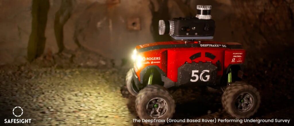
- Detailed underground mapping in areas too dangerous for personnel
- Monitoring pit wall stability to prevent landslides
- Environmental compliance tracking with regular aerial imagery
These use cases show how drones improve efficiency, safety, and data quality.

Final Thoughts: Should Your Mine Invest in UAV Surveying?
Mining UAVs represent a powerful advancement over traditional surveying methods. They deliver faster, safer, and highly accurate spatial data at competitive costs. For mines looking to modernize operations and gain a competitive edge, adopting drone technology is becoming essential.
Discover how our specialized mining drone solutions can help your team unlock these benefits and revolutionize your surveying workflows.